The Permian Basin – An Oil and Gas Sacrifice Zone that Entangles Us All

The Permian Basin is an ecosystem of extraction: pump jacks, drilling rigs, petroleum storage tanks and methane flares – all these structures stare you down as you drive from Lovington, NM to Hobbs to Eunice to Carlsbad.  Here, oil is BIG money and it touches everything.

By Ann McCartney and Clara Sims

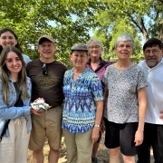
On an immersion retreat experience for Interfaith Power and Light (IPL) to the Permian on June 10-11, 2022, we were saddened gazing at well upon well of oil and gas production and met with some of the people in Hobbs who are the victims of the abuses of the outsized production here and the public health crises following in its wake. We viewed some of their homes, schools and parks, surrounded by pump jacks, storage tanks and methane flares – some literally a stone’s throw from folks’ front yards, back yards, schools, playgrounds, and daycares.

As jarring as these visuals were to take in amidst the 100 plus degree heat, it was the stories we heard that left the most permanent marks on our hearts.

Health risks for frontline residents

Women with friends and husbands, fathers and children affected by the oil and gas economy of the region told us stories of so much illness: thyroid disorder, asthma, allergies, and cancer. They told of us people developing rare and terminal cancers at the age 14 and 35 and 50 – stories of their loved ones asking each other, how can this be? How can so many people be getting not just sick, but this sick? This can’t be normal.

Local residents talk about contamination concerns

One home pointed out to us housed an oil worker who has already lost two wives to cancer living in his home next to a working pump jack.  And even when terminal sickness is not present, bad smells and contaminated water in Hobbs turns people’s eyes red when showering and causes head hair to fall out. We were told that it is essential, if you can afford it, to put a shower filter on the shower, so one is not bathed in seemingly toxic water while showering.

The women we spoke with on our journey repeated over and over again that what is needed in the Permian region are different economic opportunities. Opportunities that do not pollute the air they breathe, the water they drink. Opportunities which do not overwork and jeopardize workers safety, day in and day out.

Oil and gas is an industry deeply embedded in our state and it has been the lifeway of many for a long time. We must understand and respect these ties and histories if we are to undertake the long, hard, deliberate, and collaborative work needed to bring a vision of economic vitality and health and sustainability to our siblings in SE New Mexico.

Kayley Shoup, retreat participant Stephen Picha

We were so grateful to see so much, hear so many stories and to pray and share rituals together with water and shared concerns. As our field guides and sojourners, we had the opportunity to journey with and discuss these issues with folks from Citizens Caring for the Future (CCFF), including community organizer, Kayley Shoup and one of the local leaders and Mennonite Pastor, Nick King. Kaley and Nick are among those working tirelessly and diligently in partnership with IPL to address concerns around health, human dignity, methane rules, water concerns, and oversight to safeguard the common good and community members.

We were inspired by the tenacity of their heart-driven advocacy. With the stronghold the industry has on the communities we toured, it is herculean task to raise the ethical and moral concerns to change minds and practices.  CCFF is an important witness meeting with local citizens, educating and engaging people in actions. During our trip they were sharing the value of the Oil and Gas Threat Map.

Community members are very interested in this tool that shows threat zones that include homes, schools, hospitals, businesses, etc. which lie within a half mile of an oil facility, whether a pump jack, storage tank, or compressor station. Yes, a half mile – the homes we saw in Hobbs were less than 100 yards from a working pump jack – in the very heart of the threat zone. In addition to information, CCFF works to address health concerns and hopes to offer adequate air purifiers to those most vulnerable.

Federal methane rules need strengthening

This summer is also an important time to contact the EPA to strengthen the federal methane rules, including addressing often exempted low producing wells which produce 6% of oil and gas and produce 50% of the methane (a greenhouse gas which is heavier and 80 times more potent than CO2 in warming the planet).  Advocating for strengthened federal rules is one of the most impactful things we can do as allies to those in the Permian as well as working for just transition to new and viable economic development. Public comments will be taken on supplemental EPA methane rules in the fall and all voices are welcome.

All our efforts at advocacy, solidarity, and awareness (like simply having a conversation with someone!) make a difference. We are all one and we are intimately entangled in the Permian Basin in our lives and as we face climate disruption. The Permian support our, our, dependence on oil and gas for everything from our cars, our stoves to heating our homes.

Those living in other regions of New Mexico have a particular responsibility as neighbors with the vulnerable communities in SE and NW New Mexico. We must keep talking about the suffering oil and gas creates, the need to strengthen methane rules, as well as the monitoring and enforcement of those rules.

Our minds tell us this excess and overproduction of oil and gas is not an acceptable and safe way to live and to treat Holy Mother Earth and her living biosphere, that includes our neighbors.

Our hearts tell us that no one – no single person – should be sacrificed for the profits of an extractive industry.

Our spirits call us to raise our voices in witness and solidarity to the cries Earth and the cries of her peoples.

Let us continue to work for the common good of our beautiful, abundant state and all the peoples who call this region home. You can get more engaged by contacting IPL.

(Ann McCartney is co-chair of the NMEPR-IPL board.  Her daughter, Clara Sims, is a student at the Yale Divinity School and recently a youth organizer for NMEPR-IPL)


Oil & Gas Threat Map Shows Tens of Thousands of New Mexicans Vulnerable to Emissions

A geospatial analysis released by Earthworks in May shows 144,377 New Mexicans including 38,749 children, reside near or attend schools or day cares within a ½ mile threat radius of active oil and gas operations. See Oil & Gas Threat Map  and New Mexico Threat Map fact sheet. Here is a video of the media briefing and official release of the map.

Report: Low-Producing Wells Account for Half of Methane Pollution

A peer-reviewed study in Nature Communications provided the first nationwide look at how much methane low-producing wells are emitting. While these wells produce just 6% of U.S. oil and gas, they emit HALF of methane pollution from well sites nationwide. “Eighty percent of US oil and natural gas (O&G) production sites are low production well sites, with average site-level production ≤15 barrels of oil equivalent per day and producing only 6% of the nation’s O&G output in 2019,” said an abstract of the report.   Read full piece here
Here is another article in Reuters new service
Characteristics of US low production oil and gas well sites.
figure 1
a Spatial distribution of active onshore low production well sites (n = 565,000) color-coded by site-level O&G production in barrels of oil equivalent per day (boed) per site. The numbered boxes show a few of the major low production well site regions, including those for which site-level CH4 emissions data are available: (1)—Appalachian, (2)—Oklahoma/Kansas/Arkansas, (3)—Colorado/Utah/Wyoming, (4)—Permian Basin, and (5) Barnett Shale. b Distribution of the national number of well sites and O&G production, comparing low production sites with non-low production sites. c Box plots (centerline, median; box limits, upper and lower quartiles; whiskers, 1.5× interquartile range; points, outliers) showing the distribution of site-level O&G production in each of the five O&G production regions with large numbers of low production well sites shown on the map. The average gas-to-oil ratio (GOR, Mcf/barrel) is shown on the top x-axis. These five regions account for three-quarters (76%) and two-thirds (68%) of the total number and O&G production from all low production well sites, respectively. The horizontal lines within each box plot show the median production rate per site. On the right y-axis, the percentage of the total count of low production well sites and total O&G production from all low production well sites are shown in blue and red, respectively. d Cumulative distribution functions of site-level O&G production for all low production well sites (red line) and well sites in each of the regions shown on the map (blue line—Region 1, light green—Region 2, dark green—Region 3, orange—Region 4, purple—Region 5). e Cumulative distribution functions of low production well site age, representing the years in production as of December 31, 2019 and based on the reported first production date. Lines are color-coded as in d. Analysis based on data from Enverus Prism19 for 2019.